Trails: Information about and links to various hiking, riding, and multi-use trails in Queensland
What is a trail?
A beaten path through rough country such as a forest or moor. (Oxford Dictionary)
A route for travel over land, especially a narrow, unpaved pathway for use by hikers, horseback riders, etc. (Wikipedia)
A trail is a travel way established either through construction or use and is passable by at least one or more of the following, including but not limited to: foot traffic, stock, watercraft, bicycles, in-line skates, wheelchairs, cross-country skis, off-road recreation vehicles such as motorcycles, snowmobiles, ATVs and 4-wheel drive vehicles. (US National Recreation Trails Program)
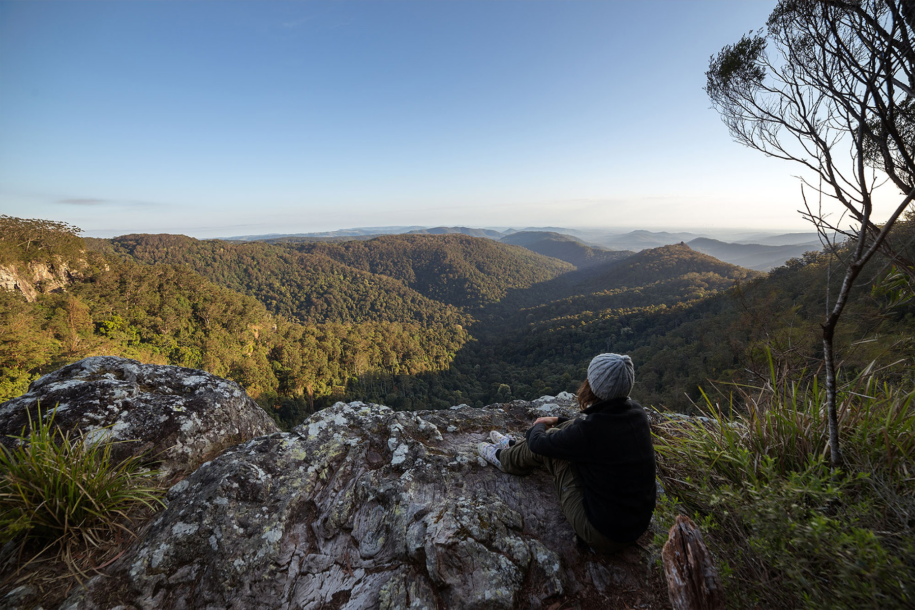
Keen to escape into dense subtropical rainforest? Bask in cool waterholes? Climb a mountain? Or stay by the coast with ocean views? Sunny Coast local Sarah Pendergrass has pulled together a list of the top places to hike on the Sunshine Coast.
The National Trail is Australia’s premier long distance, multi-use recreational trekking route, stretching an extraordinary 5,330 kilometres from Cooktown in tropical far north Queensland to Healesville in Victoria.
Variously known as ‘the BNT’, the National Trail or simply ‘the Trail’, the National Trail follows the foothills of the Great Dividing Range and the Eastern Escarpment offering self reliant distance trekkers a uniquely Australian adventure.
As it winds along Australia’s eastern seaboard the National Trail reveals some of the most spectacular scenery in the country. The Trail provides access through some of Australia’s wildest, most inaccessible country and provides endless fascination for those interested in our unique fauna and flora.
The Trail passes through some wild and inaccessible country
The National Trail was originally conceived as a route for the long-distance horse trekker but is now enjoyed by cyclists and hikers as well.
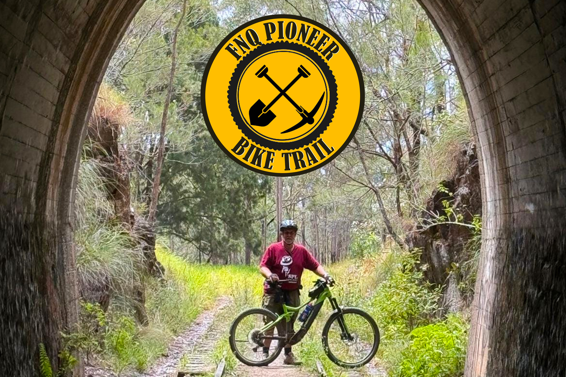
The FNQ Pioneer Bike Trail has an overall length of about 270kms giving cyclists an opportunity to spend 5-7 days in a remote area of the tropical north of Australia.
You will be cycling FNQs remote savannah and outback regions which exist alongside the tropical rainforests of coastal North Queensland. This trail is only 1.5-hour drive from Cairns international airport.
The trail is a conglomerate of quiet roads that have been used by local cyclists for many years. A mountain bike or good gravel bike is recommended. This is a trail of moderate difficulty and is quite remote. An eBike with wide tyres is an excellent choice.
AllTrails has 3,845 great hiking trails, trail running trails, mountain biking trails and more, with hand-curated trail maps and driving directions as well as detailed reviews and photos from hikers, campers, and nature lovers like you.
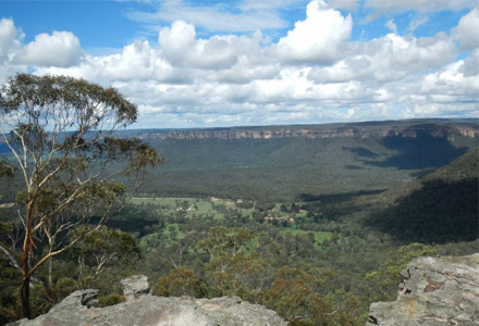
Whether you’re looking for the best trails in Uluṟu-Kata Tjuṯa National Park or Neerabup National Park – we’ve got you covered. If you’re looking for great state park trails check out Blue Mountains National Park in New South Wales or Cradle Mountain-Lake Saint Clair National Park in Tasmania. Or for some great local park options, check out Werribee Gorge State Park near Victoria or Lesmurdie Falls Picnic Area near Western Australia. Ready for some activity?
Start checking them out on AllTrails and you’ll be out on the trail in no time!
Witnessing sunrise through the rainforest canopy, smelling gum trees through the morning mist, or unhooking yourself from a wait-a-while vine are all signs that you’re out there doing it; exploring the magnificent great outdoors.
Moreton Bay is a vast region set amongst a diverse landscape, offering numerous recreational trail opportunities for bush walkers, mountain bikers and horse riders.
The Moreton Bay Recreational Trails range from short leisurely experiences for all fitness levels to more strenuous longer trails, recommended for more experienced users.
Looking for more trails? Why not explore the Wide Bay Burnett region, with internationally recognised pristine coastlines through to rugged mountain ranges, there is something for everyone to enjoy the natural wonders of the region.
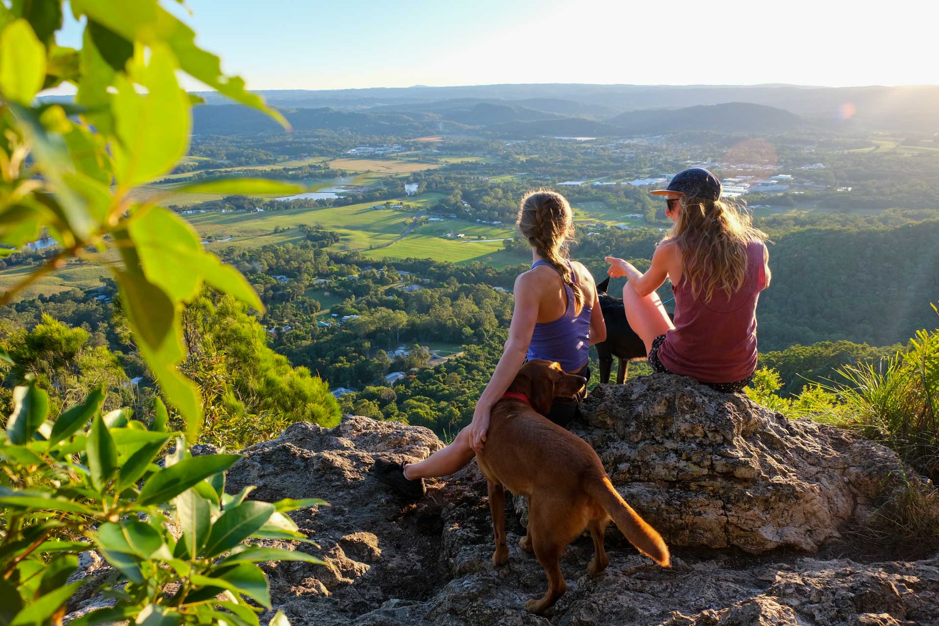
From the Coastal Pathway to horse riding, paddling and walking tracks, the Sunshine Coast has it all.
Sunshine Coast Adventures
Over 150 free, self-guided walking, cycling, mountain biking, horse riding and canoeing activities, Adventure Sunshine Coast is the ultimate guide to the great outdoors of the Sunshine Coast.
Walking and cycling maps
Explore pathways in your local area with the Sunshine Coast Active Travel Maps, designed to help you walk, ride or catch the bus from Peregian Springs through to Pelican Waters. Discover a new way to get to the beach or find a bike park for the kids using these comprehensive maps. You can view them online, or pick up a copy from council’s customer contact centres, libraries or your local bike shop.
The Great Walks of Queensland are a world-class system of walking tracks through Queensland’s protected area estate, including four magnificent World Heritage Areas, and offer a range of experiences, from short, easy strolls to half and full-day walks and extended overnight adventures, giving people of all ages and abilities the opportunity to explore, experience and enjoy the magnificence of Queensland’s parks and forests
With more than 63km of walking trails, 50km of mountain biking trails and 23km of horse riding trails, Toowoomba Region: Walks & Trails are must go destinations for the outdoor enthusiast.
164 Tourist Rd,
Toowoomba City QLD 4350
Find on Google Maps
From Toowoomba CBD head towards James Street and follow east. Turn right onto Tourist Road and turn left at the roundabout. Continue to the end of the road and find a carpark.
Description: A mix of urban parkland and bushland close to the city. The escarpment bushland area provides a lovely natural experience where visitors can escape the city and enjoy excellent views east from the Great Dividing Range. A number of walking tracks exist through the escarpment park, which are popular with bushwalkers. From the top of the range and down through bushland to the east there are a number of graded walks and a bridle trail. Ranging from an easy 500-metres to over five kilometres, the trails take the visitor into a world of busy birdlife and distinctive native flora.
Atherton Tablelands offers some of the best mountain bike and road cycling adventures in Queensland. Magnificent flowing single track, family trails, epic mountain bike rides and scenic back country road rides that will take your breath away. Atherton Tablelands is fast becoming the ultimate cycling destination in Queensland.
Rail Trails are shared-use paths recycled from abandoned railway corridors. They can be used for walking, cycling and horse riding, and meandering through scenic countryside link small country towns as railways did in the past.
The Noosa Biosphere Trails are located in the Noosa hinterland and are a popular destination for horse-riders, walkers, runners and bike riders. The trails pass through forests, mountains and rural landscapes offering a diversity of experiences for users. MAP
From current day uses and the history of times gone by, to local flora and fauna and its place in the region, as well as the vast array of sights, sounds and …
While not in Queensland, the Clarence Canoe & Kayak Trail just over the border, is the longest white-water trail in Australia! It covers more than 195 km of river between the Nymboi-Binderay National Park and the township of Copmanhurst encompassing the Nymboida, Mann and Clarence River systems. It offers spectacular scenery, an abundance of wildlife and some exhilarating whitewater adventure!
With endless, clear, sunny skies and nature aplenty, there’s a range of great options for walking in Brisbane. We’ve scoped out the best options for a bushwalk, riverside walk, and even the best lookouts in Brisbane. So, lace up and get ready to see views of Brisbane from new and exciting perspectives.
Queensland Stock Routes
A stock route, also known as travelling stock route (TSR), is an authorised thoroughfare for the walking of domestic livestock such as sheep or cattle from one location to another in Australia. The stock routes across the country are colloquially known as The Long Paddock or Long Paddock.
A travelling stock route may often be distinguished from an ordinary country road by the fact that the grassy verges on either side of the road are very much wider, and the property fences being set back much further from the roadside than is usual, or open stretches of unfenced land. The reason for this is so that the livestock may feed on the vegetation that grows on the verges as they travel, especially in times of drought. Source: Wikipedia
Stock routes have no separate title or tenure from the underlying road. The same roads are used for walking and agisting stock and vehicular transport. Reserves for travelling stock include camping and water reserves, pasture reserves and trucking reserves.
The network is primarily used by the pastoral industry:
as an alternative to transporting stock by rail or road
for pasture for emergency agistment
for short-term grazing.
A stock route can be a road or route identified as a stock route on the stock route map, or it may simply be any route that is customarily used for walking stock. See the Stock route maps
Can you camp on stock routes in Australia?
Setting up camp along these stock routes for the traveller is a time-honoured tradition, one that also stretches back literally tens of thousands of years in Australia. Taking in the traditional need or want to ‘go walkabout’ or ‘go bush’, or to travel for any number of reasons. They were the country roads before we had roads and wildlife tracks before we had cattle mobs on the move. However, you can’t just camp anywhere along a stock route and camping is generally subject to the regulations imposed by the state or territory.
Camping up in these reserves though is a special privilege, and we should not forget the local livestock and wildlife rules. Access to the water on these reserves is a communal necessity, so camping on the track leading down to the water source is a legally enforceable ‘no-no’. Source: RV Daily
The Brisbane Valley Rail Trail (BVRT) follows the disused Brisbane Valley rail line that commenced construction at Wulkuraka near Ipswich in 1884 and was completed at Yarraman in 1913. The BVRT winds its way up the Brisbane valley, traversing farmland, forests, picturesque rural settings and country towns. Being on the old railway line, the BVRT provides an easy climb up the valley for day trippers, overnight camping or longer term adventures.
The BVRT utilises the former Brisbane Valley railway line from Wulkuraka, near Ipswich, to Yarraman, west of Kilcoy and provides recreational opportunities for walkers, bike and horse riders. It is not your average rail trail; from the 20 minute ‘just going to stretch my legs’ walker to the 322 kilometre ‘end to end and back again’ endurance rider, this rail trail truly has something for everyone. Learn More.
The Department of Transport and Main Roads (TMR) is the state agency responsible for the day-to-day management and maintenance of the BVRT in conjunction with Ipswich City Council, Somerset, South Burnett and Toowoomba Regional Councils, and The Ambassadors of the BVRT–Moore Linville Benarkin Blackbutt Inc.
TMR has produced a five-year Strategic Plan for the BVRT that provides a blueprint for the future development and management of the rail trail with a focus on identifying tourism and marketing initiatives. Read Full Story
The Department of Transport and Main Roads (TMR) and Somerset Regional Council collaborated with The University of Queensland’s Business School Service Innovation Alliance (SIA) to carry out visitor research on the Brisbane Valley Rail Trail (BVRT).
In August 2021, Council released the BVRT Visitor Research Report which analysed trail usage through late 2020. The report contains extensive information on local and visitor usage, including visitor profiling, trip characteristics, information touchpoints, travel motivations, visitor spending, visitor experience and visitor sentiment. The report is a must read for tourism operators servicing BVRT users.
To assist in consuming the report, Council has produced the attached four page Infographic. The infographic highlights selected non-local user statistics that may be of assistance to business operators in the region.
Track Grading System
The Australian Walking Track Grading System (AWTGS) classifies tracks into 5 grades, based on the Australian Standard for walking track construction (AS 2156). It was funded and developed by a Victorian Government initiative, in partnership government agencies and non-government groups across Australia.
Quick Reference
Grade 1
No bushwalking experience required. Flat even surface with no steps or steep sections. Suitable for wheelchair users who have someone to assist them. Walks no greater than 5km.
Grade 2
No bushwalking experience required. The track is hardened or compacted surface and may have a gentle hill section or sections and occasional steps. Walks no greater than 10km.
Grade 3
Suitable for most ages and fitness levels. Some bushwalking experience recommended. Tracks may have short steep hill sections a rough surface and many steps. Walks up to 20km.
Grade 4
Bushwalking experience recommended. Tracks may be long, rough and very steep. Directional signage may be limited.
Grade 5
Very experienced bushwalkers with specialised skills, including navigation and emergency first aid. Tracks are likely to be very rough, very steep and unmarked. Walks may be more than 20km.
Currently, the Queensland Government is exploring the following ecotourism opportunities as part of this program (with additional future opportunities expected):
The objectives of the Queensland Ecotourism Trails Program are to better protect, present and maintain our national parks and to work with Traditional Owner groups, councils, community and industry to create local jobs.
It’s about conservation, protecting biodiversity and offering tourism in an ecologically-sustainable manner.
The Nature Conservation Act 1992 (NC Act) provides for development of low-impact, purpose-built ecotourism infrastructure on national parks that is ecologically sustainable, is in the public interest and, to the greatest possible extent, preserves the land’s natural and cultural condition.
The Queensland Government also recognises the need to capture a greater share of higher yielding nature-based visitors. This is reflected in the Queensland Ecotourism Plan 2016-2020, where one of the five strategic directions is stimulating investment in new and refurbished ecotourism opportunities.
Great Walks is Australia’s ultimate walking magazine. Every issue is packed with gear guides, product reviews, advice on the best travel destinations, inspiring real-life accounts from seasoned walkers and practical information on specific walks and their accompanying maps.
Have an interesting or useful resource or link to share?
Let us know by Recommending a Resource
Become a member of Outdoors Queensland
Step outside and be part of the larger outdoors community. Being a member is an incredible opportunity to strengthen Outdoors Queensland's impact through our collective voice and effect real, positive transformation across the outdoor sector.
Joining Outdoors Queensland means becoming a part of the larger outdoor sector. As a member, you'll have the support of a network that understands and shares your passion for the outdoors.
Strengthen Our Collective Voice
Membership of Outdoors Queensland amplifies our collective voice on critical issues affecting the outdoor sector. Together, we can advocate more effectively for the interests of our community.
Access Resources and Information
Members of Outdoors Queensland gain exclusive access to a wealth of resources and information that can support their personal and professional development in the outdoors sector.
Emails You Will Look Forward To Reading
Stay on the pulse of the outdoors in Queensland through a subscription offering monthly insights from EO Dom Courtney, the latest news, upcoming events, and job opportunities in the outdoor sector.
Use the form or click Subscribe Now! to share your areas of special interest.
Enter your search terms below
Outdoors Queensland respectfully acknowledges the Traditional Custodians of his land, their elders past, present and emerging, for the important role Aboriginal and Torres Strait Islander peoples continue to play in Queensland and most especially on the land, air and waterways used for outdoor recreation.
The ancestors of Aboriginal and Torres Strait Islander peoples have walked this country for generation upon generation and we acknowledge their special and unique place in our nation’s historical, cultural and environmental identity.
Artwork: ‘Journey along the Riverbank’
by Stephen Hogarth